Day One. Geneva to Chounaz
Smoothly through bag checkdrop or whatever it is called at T5 for the 11.40 to Geneva – no bemused faces as we processed our well-packed bikes in their clear plastic bags.
Twist and turn the handlebars under the cross-bar, lower saddle, deflate tyres 30% and remove pedals. Suggest you procure some latex gloves to keep the hands clean-ish. Tape up bag with packing and FRAGILE tapes. Carefully make sure anything remotely sharp is in the hold to avoid consternation at security.
Geneva and everything arrived perfectly. 30 minutes of reconfiguring the bikes before a nifty to get over to Grand Saconnex. If you fly to Geneva the best way to get into and through Geneva or go east around the lake is to follow a bike lane right outside arrivals eastwards. This goes through, and under the front of the airport before you arrive at an underpass that takes you under the motorway and up to Chemin Edouard-Sarasin. Turn left and head to the junction with Rue de Ferney and turn right on to Ferney and head down to the lake, passing near the UN. You reach Route 1 that can take you to the lake eastwards, or, carry on down to the front and the fountain etc.

All the above tidily achieved we headed east to France and Annemasse for the delights of Decathlon.
Geneva is a very grand place, bulging with the splendour of late 19th and very early 20th century hotels and apartment blocks. The suburbs of this unusual city seem endless but the roads are reasonably safe. There are trams and their tracks to keep an eye out for, plus the bus-trams and the buses! Geneva is pricey. You can use Euros but will get change back in unhandy CHFs. In France and Decathlon, we procured Primus Gas (screw top) from the outdoor pursuits equivalent of Willy Wonka’s factory. D fell for a leisure top that gave new meaning to cheap and cheerful.
St Jeoire and Chounaz were a 25-mile slip of a ride away from the aeroport. We picked up supplies at a whimsily stocked Casino (Carrefour, Intermarche, Casino are the main French supermarches; there are also Super-U, Proxi, 8 à Huit – more like Londis – and the multi-nats of Spar, Lidl, Netto and Aldi). The campsite at Chounaz is at the very top of a steep hill – after a very, very sharp left half a mile out of town.

Do not forget anything from the shop as there is nothing on offer at what is pretty much a Camping à la Ferme. At 16€ this was pricey for very basic amenities. However, a great location partially made up for it. Semi-final night and the roars of the French rose up from the valleys below as they scored twice and made it to the final whistle.
Day 2 to St Jean de Sixt
A sluggish start – lots of faffing and dawdling meant a late start. It takes a while to get back into the swing of camping and there we were at 9.30am after the first night stood in piles of clothing and bits. And, since we seem incapable of riding any distance without a belly fully from boulangerie and bar, we didn’t approach the D4 until approaching 11am. Heat of the day and the morning already history, we had the beauty and beast of the Col de la Colombière to ascend. This is a tough climb albeit with the pleasant interlude of easy gradients at La Reposoir.
From Scionzier’s side the climb averages 6.8% with a max of 12% and it ranks 230 in France for difficulty at climbbybike and is harder than the climb from the south. Frequently passing through forests there was no breeze to offset the searing midday heat. These things are best tackled early and not by the characters of Dumb and Dumberer at lunchtime. Cyclists were flying back down as we started and many of whom were out training for the weekend’s Etape 2016. The Etape is a TdF-related event that runs the course of one of the Tour’s stages – this year’s number 20, Megève to Morzine. It is not for tourers weighed down by tents, camping gas and a spare pair of shorts.
Cycling up a col one can easily become a hazard on narrow roads for cyclists coming down. Cars and vans can be heard approaching but cycles just appear out of nothing and if you have strayed from the right into the middle on a corner you are suddenly a dangerous piece of road furniture.


I creaked up the mixture of 8, 9 and 10% gradients and eventually resorted to stopping every two kms. The breaks in the forest allowed great views, as is the way of the mountain passes, but it was a painful reacquaintance with them thar hills, and one I no longer relished as my heart pumped in my ears and the sweat sloshed, dripped and stung, and my back throbbed. The hills hadn’t changed but I had. My compadre was suffering from the increasing problems of having no arch on one foot and there was the threat of heavy weather eastwards. However, it was the sheer size of Iseran that made me change plans. At 54, I was finally considering the marginal propensity to enjoy an effin’ great hill – and the current colossus that lay beneath my tyres was only 1600m: Iseran is just short of 2800. No more Cols with tents!
We reached the top, to the applause of those who had passed us.

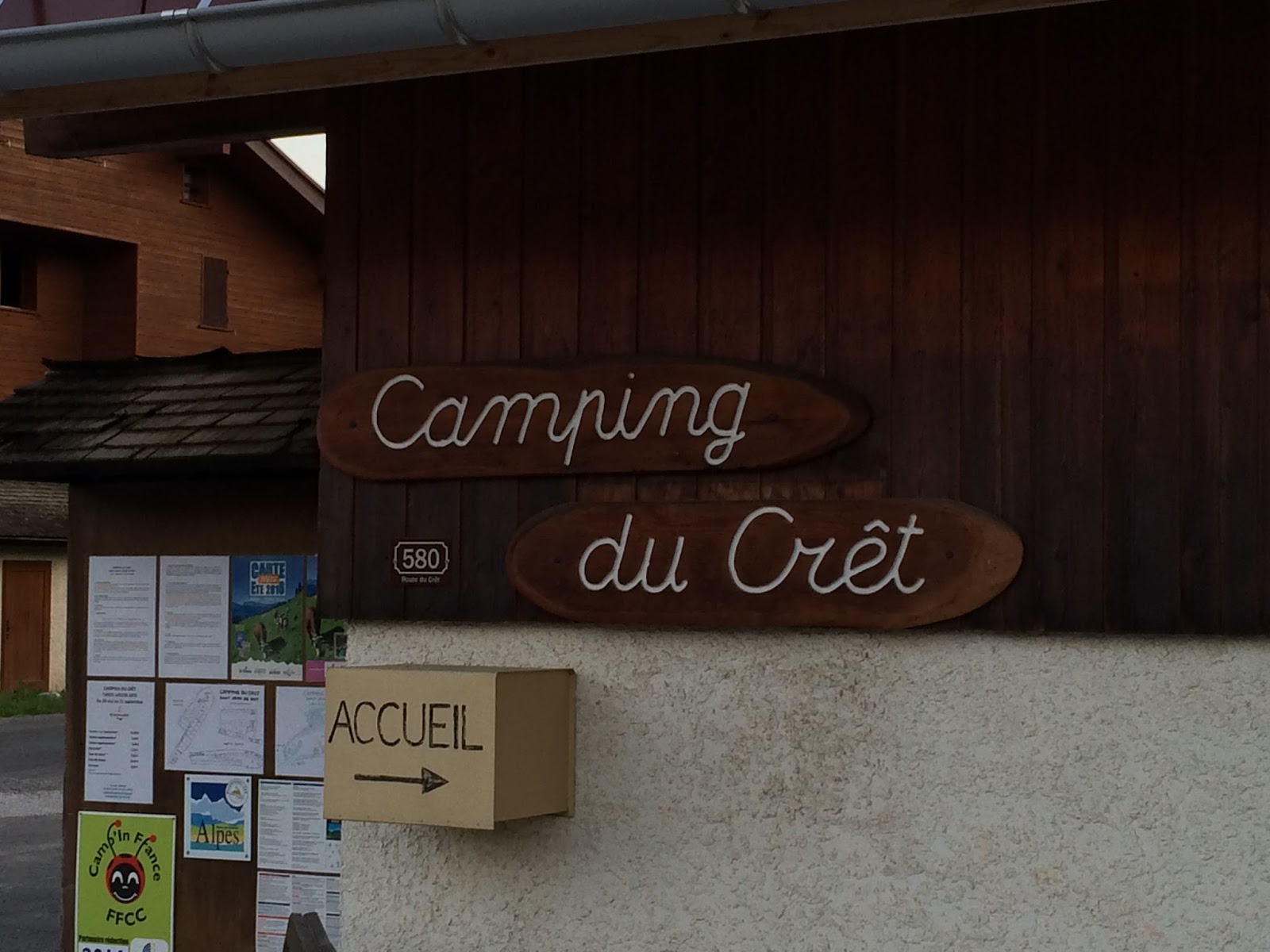
There are none of the spectacular views up on top of this one that are usually found on a col and not a lot to hang about for except for food. We paid a whacking 16€ for two fizzy drinks and baps and headed off for the rollercoaster downhill into St Jean de Sixt and the wonderful Camping du Crêt.
Also perched atop steep hill and one that affords fantastic views of the mountains around, the site’s tent section is separated from the more cramped vehicle pitches and amenities by a very un-busy road. Good amenities at 12€. One minor drawback was the excitable horse just over the fence that neighed imploringly every minute or so until the owner drove in. There was also some barkage of rumpy-pumpy origin that eminated from beyond the fence in the early hours.

The village has a 8 à Huit foodstore open ‘til 7.30 and a couple of unmemorable bars. We had decided over beers in the bar whatnot that evening that we would head west to Seyssel the following day, where we camped out on our first ever night in the Alps back in 2008. This would set us up for a couple of unloaded outings on the border of Ain and Rhône-Alps. But rather than head straight down the valley through Thônes to Annecy we would continue south east over the Col des Aravis. Back to the site and an extraordinary night sky, unpolluted by ambient light. We lay on our banks and observed The Plough, The Toaster and The Iphone.

Day Three to Seyssel
A splash of dew held up our swift departure. I’ve got into the habit of packing the ten away as one. This allows for pitching in about three minutes. I separated the inner and outer and dried them both on handily placed wooden fencing panels. I then fastened them back together so the tent could go up damn fast in the evening– handy if there was rain about. The very well-ridden Col des Aravis begins in the village at 920m and means the col is a short climb of just 560 over 10km and relatively easy from this, the north side. It will be crossed for the 40th time in this year's TdF, being a well used second category climb en route to other climbs. The road connects two ski resorts - La Clusaz and Flumet - and is busy. It is beauty and no beast.
Comfortable to climb as we did at 8.15am, topping at 10.00, and, being so popular, there are a stack of stores at the summit.

The summit is preceded by a spectacular valley with overhanging sheer crags and forests after a pretty climb from La Clusaz.

The south side is certainly steeper than the northern ascent and we were in Flumet in no time to attack the boulangerie.

From there it was all downhill to the Piste Cyclable at Ugine – except it wasn’t as there was a Route Barrée on the D1212. We investigated what looked like a substantial road block that was undoubtedly off-putting to anyone thinking they could sneak around whatever the barrée was about. ‘Risque Mort’ was enough to make me turn back. There was a major landslide the week before, it turns out. The subsequent dreaded Deviàtion didn’t mess about – the D109 took us up 250m in 3k – not a happy gradient when you were expecting to be zooming downhill. If you are going that way check the status of the D1212. We cruised down into Ugine, found a Carrefour for a picnic before proceeding in a westerly direction on the very handy Piste Cyclable. One could say we took the Piste. It is approx a flattish 40k to Annecy from Ugine. Valley floors are flat but can be very hot and a bit dull, especially if the vegetation closes in around to spoil whatever view there is. Eventually the cycle way drops down to hug the superbly unreal blue of Lac Annecy and in no time you are sucked into this watery playground of the nearly rich.

Snuck out of Annecy westwards to pick up a road, the D14, to Poisy and beyond. This was great cycling country and probably underrated being stuck between the Jura and the Alps. The hillage kept ticking over before we arrived at the spectacular Gorges de Val du Fier that took us through a ridge to the Rhône valley for the short ride up to Seyssel and Camping Nantraz perched on the ice blue river’s bank.


The campsite had changed hands since our 2008 visit. Replacing the humble municipal was a campsite with restaurant and an activity holidays outfit. And it was a live music venue. Briofeet were serving up a funk and roll stew. Fortunately I was so pooped I fell asleep despite their originality in doing a Black Magic Woman cover. We booked into Nantraz for three nights at 14€ per night. Good amenities and nice fruity Affligem beer on tap. Barkage from excited school kids was annoying.
Day Four Amberieu and back
This was a simple day in which we cycled to Amberieu en Bugey 40 miles away through a gorge. We stopped at Culoz, the starting point of the easier aspect of the Col du Grand Colombier. The small town’s square was bedecked in TdF and Euro2016 bunting and flags. It was France’s big day against Portugal. We were boiled then simmered in the roasting valley. Being a Sunday, you had to grab lunch at whatever you could find in the morning as very few shops are open after 12.30.

We returned to Culoz by train then took the Via Rhona cycleway back to Seyssel. Via Rhona is a combination of road and path the takes you from Geneva to Marseilles and is also Euro veloroute 17. The campsite had viewing/sleeping area for the Final of Euro 2016. We enjoyed the local’s enthusiasm for the French National Anthem. We were less impressed by their enthusiastic applause and laughter in seeing Ronaldo eventually limp off after three attempts. From that point on, in spite of joining in with oohs, aahs and ooh-la las, we wanted Portugal to win but as the match was so boring we left to stare at the starlit sky. Over a couple of beers and a bottle of July 2016 red acquired earlier from the extremely handily placed Carrefour Hypermarche across the road from the site, we conspired to get up very early the next day to address the challenge of the Grand Colombier. The weather (previsions) was forecast to noise dive at 2pm and so we needed to be back by 1pm to button down the hatches. Rain and thunderstorms were set to prevail from Monday afternoon and evening. More at http://en.viarhona.com/
Day Five Col du Grand Colombier

We managed to reach Anglefort at 8.55. This is the start point for the harder of the four routes. 15.7km, 1250 climb averaging 8% and a max of 14%. These figures are from cycling challenge and a bit misleading as there is quite a stretch of 0% near the top that brings the average down. It is a peculiar climb in that, like Ventoux, it doesn’t go anywhere other than down the other side. It is not a classic alpine climb (it is not in the Alps for a start) during which you climb up a valley to a pass en route to the next valley. Neither Ventoux nor the Grand Colombier have the usual profile of the classics – a gradual climb that finishes with a steep rise to the col, thanks to the efforts of a glacier eons ago. Instead, the difference in profile means that you go up the side of a mountain to its top which makes for steeper everything but for a shallower summit. There is also less traffic as anyone with any sense just drives around the mountain on the main road way below. For most part, the first 10k must average over 10%. There is 3k of 14% average, which was a killer. You leave the D992 at Anglefort and wind up through the forest.

The camber on some of the bends are knee cracking. You get to the horrors of the 14% then eventually clear the forest to enjoy the easier climb to the summit. Monster. No beauty, just beast. There are superb views from the top but the forecast weather was gathering and so the views were not crystal clear.


Like Ventoux, it is very windy at the top – and chilly - so make sure to take a warm top. Also, there are no amenities from Anglefort so if you need extra water or food you will have to carry it with you (I got through two litres of water and three bananas). I would not recommend trying this route loaded! As the weather was moving in we did not have the time to descend to Culoz for coffee as that would have meant an hour and half to get back. Instead with speeds of 45mph, we managed the descent back in 25 mins. My front brake was screaming: 14% stretches followed by a sharp hairpin were conducive for a change of underwear. Thankfully there is little traffic this way. Hairy thrill stuff. Campsite at 1pm, cooked up a pile of spag with a tasty Provencal sauce just in time for the heavens to open and the thunder to clap our successful mission. The weather caved in well and truly overnight with heavy rain and a light show.
Day 6 to Geneva
Packed up in a gap between the rain and took off North on the Via Rhona to get back to Geneva. Early on this rose high to Usinens – a very pretty ride and a nice quiet road. We eventually met the Rhône at the impressive gorge overlooked by the Fort l’Ecluse.

The remaining journey to the airport was easy going but got wetter as we made to the departures. Suggest you buy food and water elsewhere as airport charged 9.90CHF for a bap and 4.80CHF for 500ml bottle of water – about £12 in all. Ouch! Since 2007, D and I have flown twenty times with BA with our bike-a-bag method. It has always been BA whom we dealt with and by and large we have had no trouble getting the bikes on a plane in this manner. Having decided that this would be our last Col/camping/flying experience, it seemed fitting then that on our very last flight, we get the trouble. The Geneva airport oversized baggage jobsworth just would not take the bikes as they were due to the damage to bikes they’d experienced. This was in spite of our bikes having arrived this way just six days before. We also argued that bikes got treated better in these bags as they would not get thrown around. He was having none of it and so we had to purchase two bike boxes at 20CHF each (about £16) – cash not cards. This I pointed out increased the danger to the bikes and lo- and behold – as we waited in the departure gate we saw our boxes up on one end, then upside down and then being dropped. However, the bikes were in one piece when unpacked at LHR and with no visible signs of damage. I must apologise to LHR staff for the callous way in which we left the empty boxes in the baggage reclaim.
Equipment
I didn’t go near a plug socket thanks to the Portapow. This kept everything charged up nicely. I tied it onto the back rack and charged my phone and/or powerbank as I cycled, then charged the Garmin once at the campsite. My compadre had to leave his phone in the toilets, showers or wherever he could find a socket. He left it the Nantraz bar while the owner was about then came back to collect it a bit later and the place was locked up.I opted to buy week’s data roaming on EE for £12. This was cheaper than buying beers just so that I could sit in a bar and more reliable than campsite/café wifi availability. EE no longer allow data roaming as and when you want as it claims people were forgetting to turn it off and then complaining about thousand pound roaming bills when they returned home.
The Garmin. Just before I left for the Alps I claimed that .gpx routes are trouble free. Only 7 miles out of Geneva on the first day and the damn thing crashes; 7 miles later it crashes again. I decided to ditch the routes I had made with Strava and just set a pin and get directions to that instead if I needed any navigating. During the gorge ride on 10th, I lost the GPS fix and this appears as a straight line, along which I managed to cycle at 57 mph, it seems. My compadre’s Galaxy recorded the ride perfectly. However his elevation was, on every ride, a lot higher than mine. (Both of us uploaded to Strava). Finally, during the ascent of the Grand Colombier, the grade kept resetting to 0.0. The ride was recorded OK but this handy stat was all over the place during the ride. I know someone reading this will be wondering why I still haven’t chucked the contraption into a lac.
My first mountain tour with the Ortlieb kit – waterproof and spacious, though pockets and similar of Altura were missed.
And no cramp - even with contortions required to get in and out of my tent. Can't say these were 100% responsible but give them a go. Other flavours are available...
High5 Zero at Wiggle from £3.49 - click link to go to Wiggle.

No comments:
Post a Comment